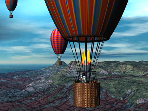
Balloon Trip over Wollongong
This was created using an Australian Digital Elevation
Map.
The roads were mapped on scanning the Central Mapping Authority
Maps
and aligning the compilation to the Phtoshop DEM greyscale map.
The balloon canopies were created in Amorphium. Figures
from Poser
and the rest in Bryce. The ropes are procedural Bryce textures.